Volume I of III Draft EIR
COVER 204kb
TITLE PAGE
448kb
I.
SUMMARY 160kb
III. GENERAL DESCRIPTION OF ENVIRONMENTAL SETTING 44kb
IV. ENVIRONMENTAL IMPACT
ANALYSIS
A.
Earth 100kb
B.
Air Quality 76kb
C.
Water 60kb
D.
Plant Life
100kb
E.
Animal Life 72kb
F.
Noise
64kb
G. Light*
H.
Land Use
60kb
I. Natural Resources*
J. Risk of Upset*
K. Population*
L. Housing*
M. Right-of-Way and Access*
N.
Transportation and Circulation 68kb
O. Public Services
1.
Fire 68kb
2.
Police
44kb
3.
Schools
48kb
5.
Libraries
40kb
Q. Utilities
1.
Power 56kb
2.
Natural Gas 72kb
4.
Sanitary Sewers 88kb
6. Solid Waste*
R.
Safety 68kb
S.
Aesthetic Resources/View 72kb
V.
GROWTH-INDUCING IMPACTS
56kb
VI.
ALTERNATIVES
68kb
VII.
IMPACTS DETERMINED TO BE INSIGNIFICANT
60kb
VIII.
ORGANIZATIONS AND PERSONS CONTACTED, REFERENCES
56kb
IX. ESAC ACTION, NOTICE OF PREPARATION AND RESPONSES
IX
part 1 of 3 EAF
296kb
IX
part 2 of 3 NOP 160kb
IX part 3 of 3 Responses 748kb
*Impacts determined not to be significant are addressed in this EIR under Section VII, Impacts Determined to be Insignificant, and have been omitted from the Impact Section of this report.
X. APPENDICES
Volume II of III
A. Geotechnical Assessment (through Appendix E)
Part 1 of 6 2.8 Mb
Part 2 of 6 3.8 Mb
Part 3 of 6 1.8 Mb
Part 4 of 6 3.1 Mb
Part 5 of 6 2.6 Mb
Volume III of III
A. Geotechnical Assessment (from Appendix F)
Part
6 of 6 2.4 Mb
B.
Air Quality Assessment Data 136kb
C. Psomas Report
1.
Sewer Study 92kb
2.
Water Study 172kb
3.
Hydrology Study 1.1 Mb
D.
Biota 1.4 Mb
E.
Noise Data 1.3 Mb
F.
Traffic Analysis Report 1.3 Mb
G.
Phase I Archaeological Survey/Paleontological Records Search Results
884kb

LIST OF FIGURES
Provided as .jpg files
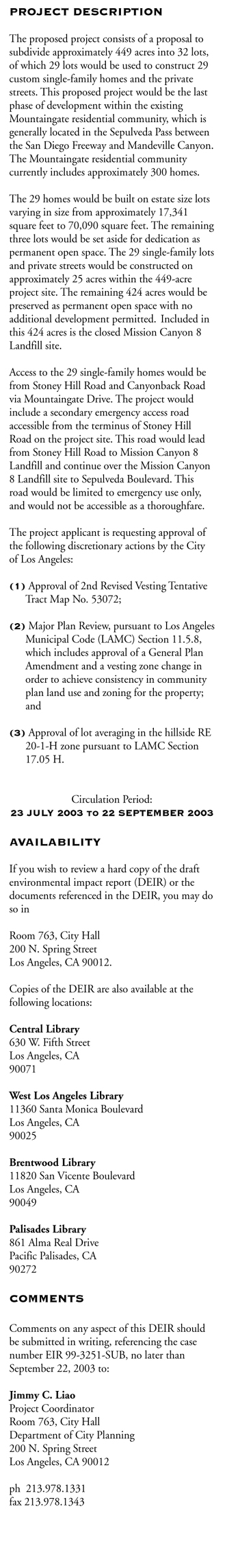
I-1 Project Location and Boundaries 120kb
II-1 Regional Location 124kb
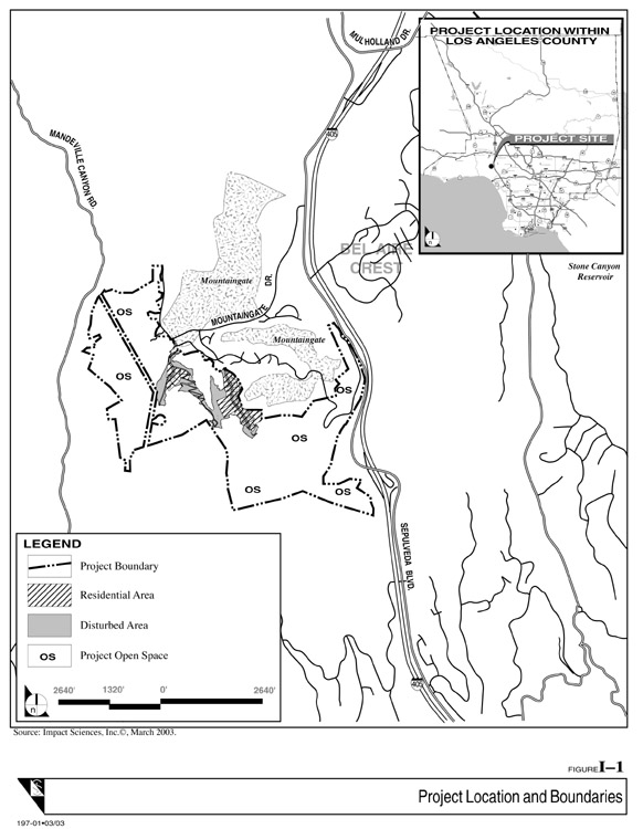
II-2
Site Vicinity 104kb
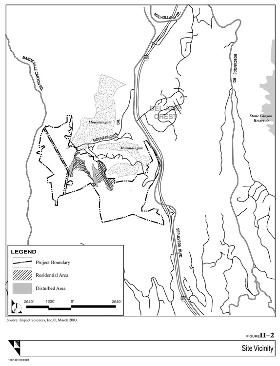
II-3
Originally Approved Mountaingate Master Plan 136kb
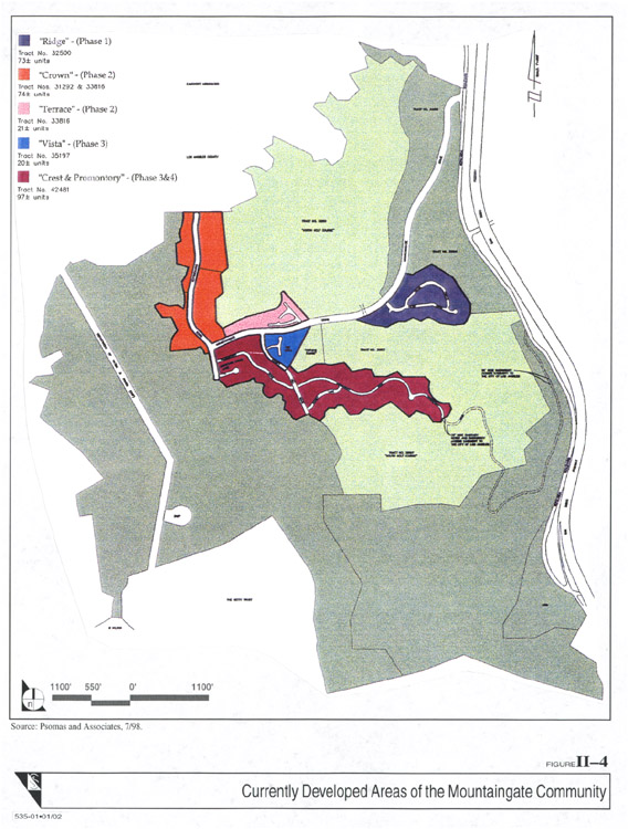
II-4
Currently Developed Areas of the Mountaingate Community 152kb
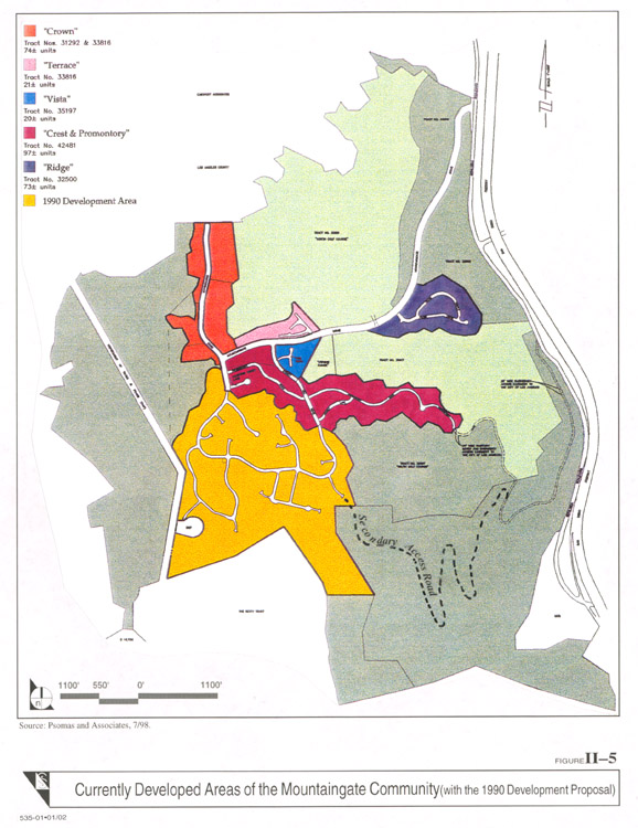
II-5
Currently Developed Areas of the Mountaingate Community
(with the 1990 Development Proposal) 152kb
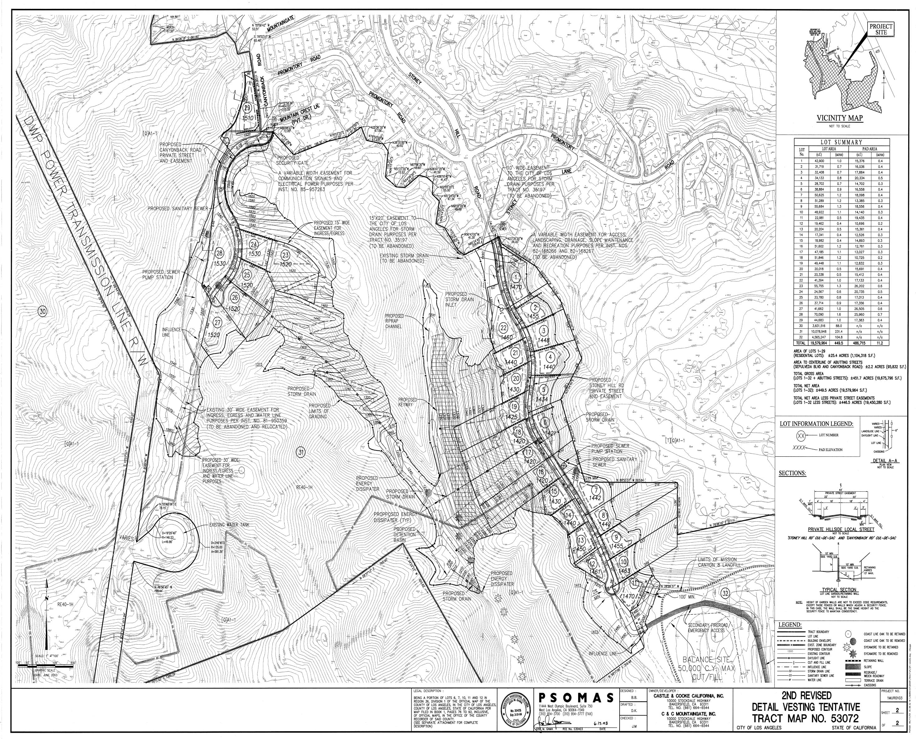
II-6a Second Revised VTTM 53072 (Map Pocket) 1.9 Mb
II-6b
Second Revised VTTM 53072 (Map Pocket) 1.8 Mb
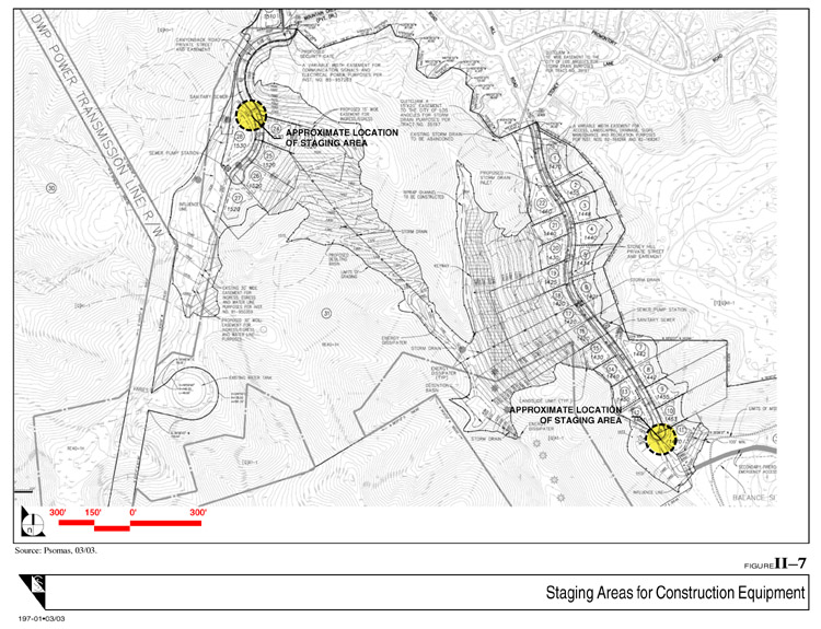
II-7
Staging Areas for Construction Equipment 172kb
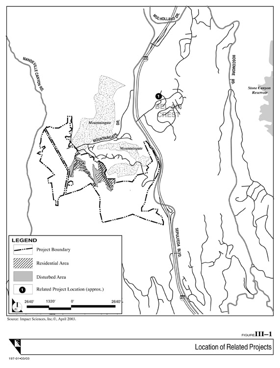
III-1
Location of Related Projects
104kb
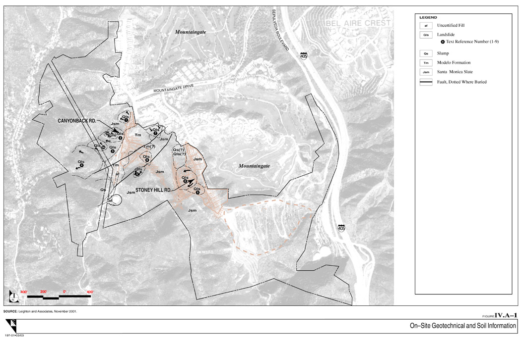
IV.A-1
On-Site Geotechnical and Soil Information
200kb
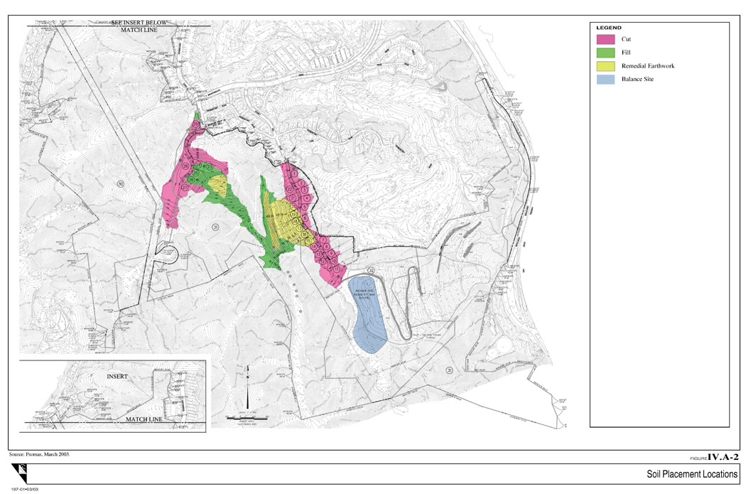
IV.A-2
Soil Placement Locations 204kb
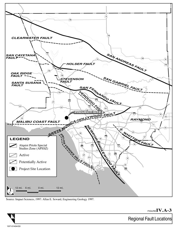
IV.A-3
Regional Fault Locations 116kb
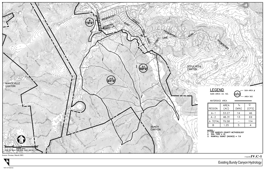
IV.C-1
Existing Bundy Canyon Hydrology
328kb
IV.C-2
Proposed Hydrology and Storm Drain System 340kb
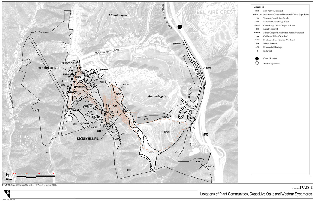
IV.D-1
Locations of Plant Communities, Coast Live Oaks and Western Sycamores
220kb
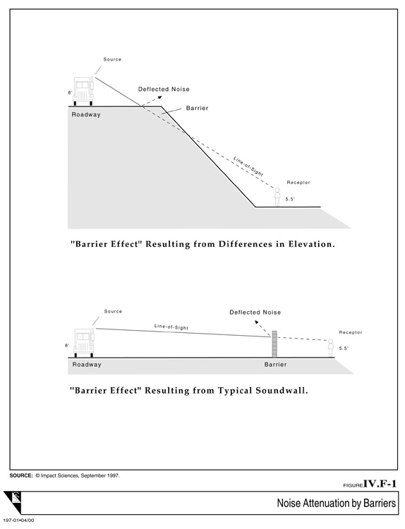
IV.F-1
Noise Attenuation by Barriers
52kb
IV.F-2
Staging Areas for Construction Equipment 172kb
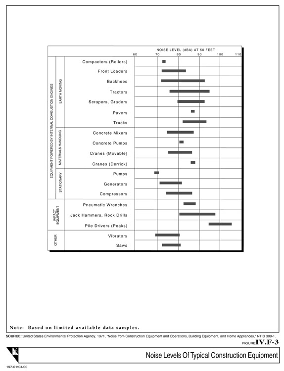
IV.F-3
Noise Levels of Typical Construction Equipment
76kb
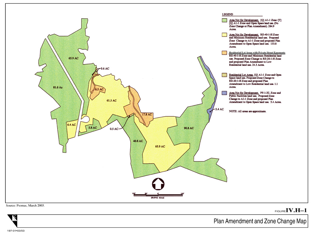
IV.H-1
Plan Amendment and Zone Change Map
180kb
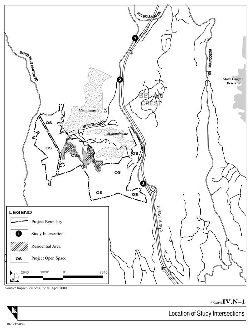
IV.N-1
Location of Study Intersections
172kb
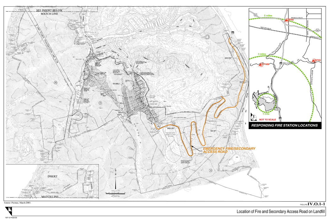
IV.O.1-1
Location of Fire and Secondary Access Road on Landfill
260kb
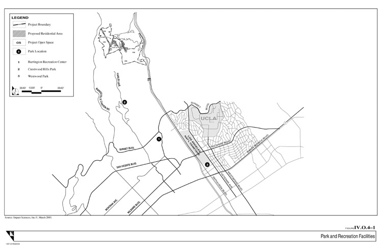
IV.O.4-1
Park and Recreation Facilities 68kb
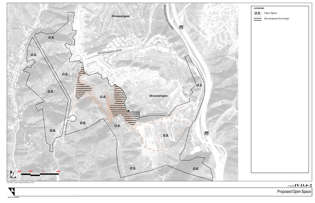
IV.O.4-2
Proposed Open Space
184kb
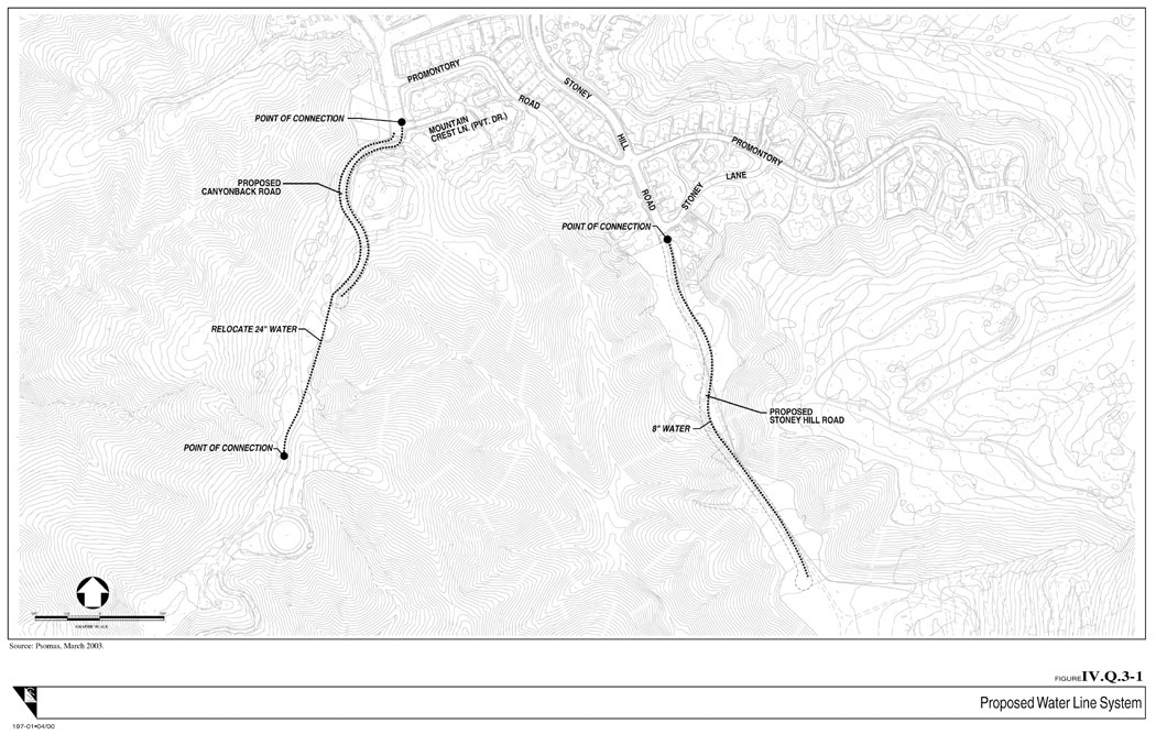
IV.Q.3-1
Proposed Water Line System
216kb
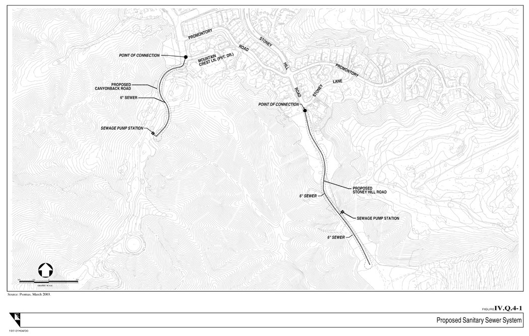
IV.Q.4-1
Proposed Sanitary Sewer System
208kb
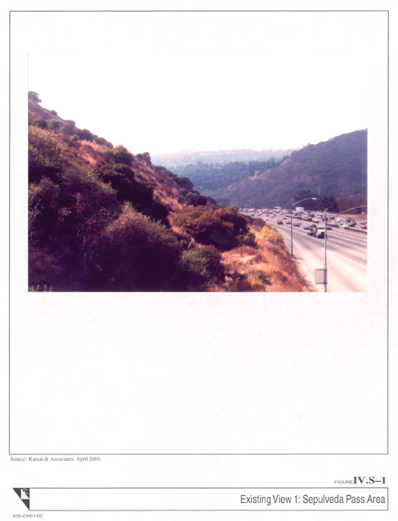
IV.S-1
Existing View 1: Sepulveda Pass Area 80kb
IV.S-2 Existing View 2: Mandeville Canyon Area 252kb
LIST OF APPENDIX FIGURES
Provided as .jpg files
Appendix A Geotechnical Assesment
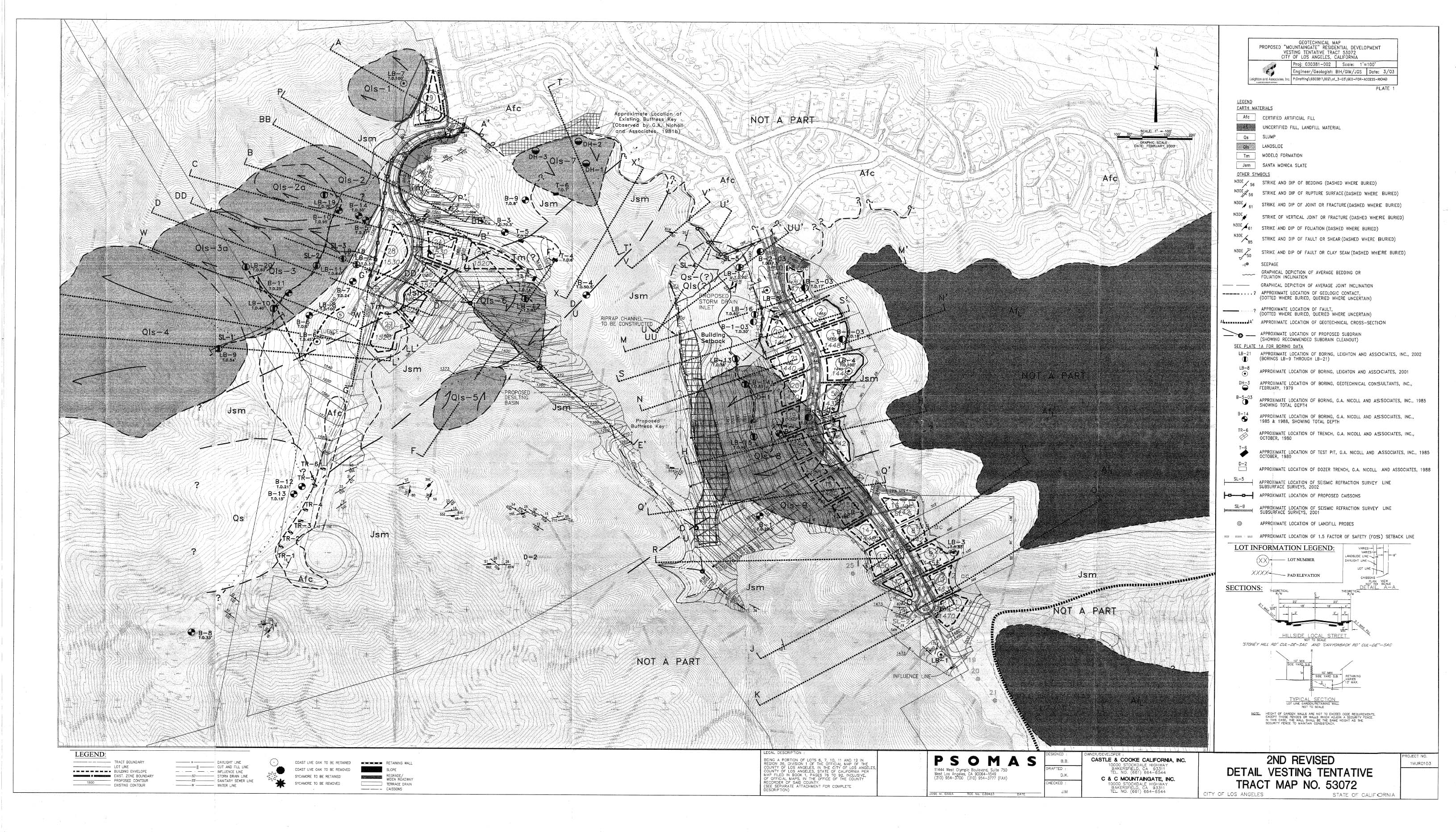
Geotechnical Map 1.6 Mb
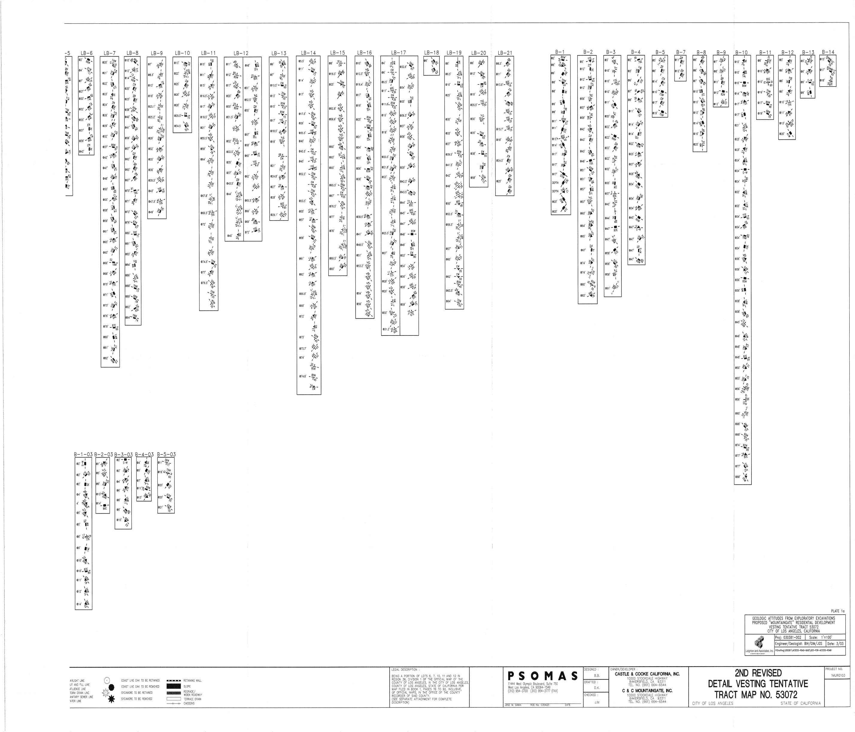
Geotechnical Attitudes from Exploratory Excavations 504kb
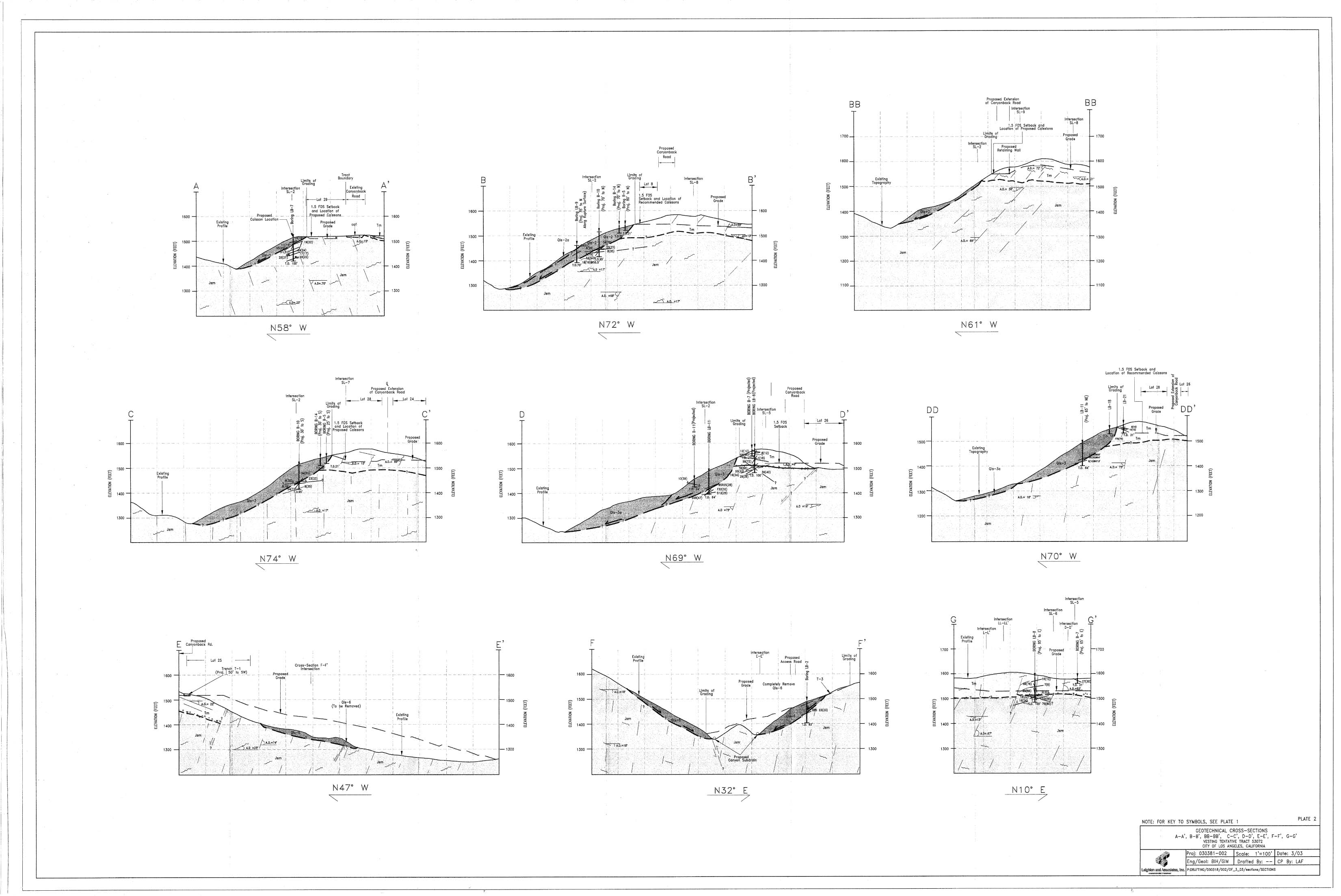
Geotechnical Cross Sections A-B 472kb
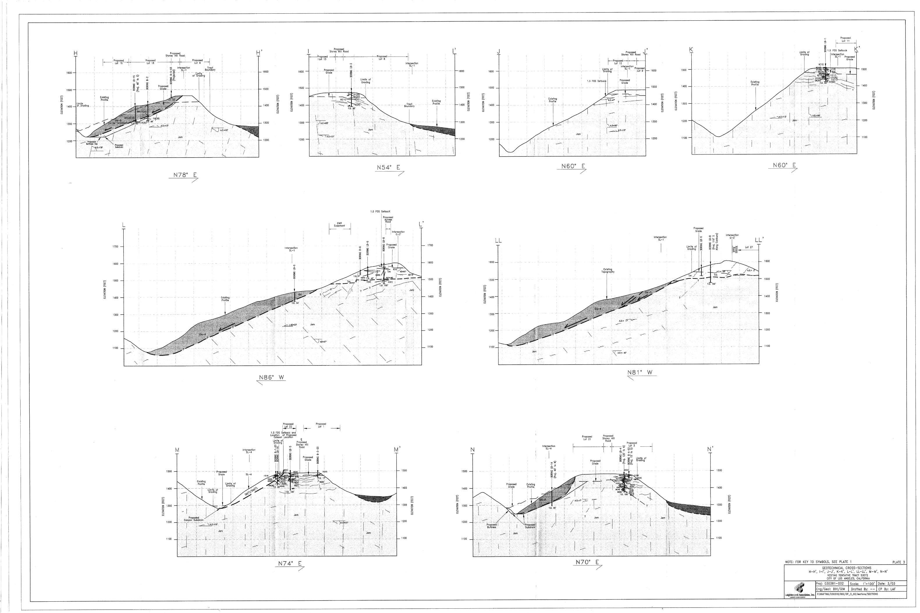
Geotechnical Cross Sections H-N 468kb
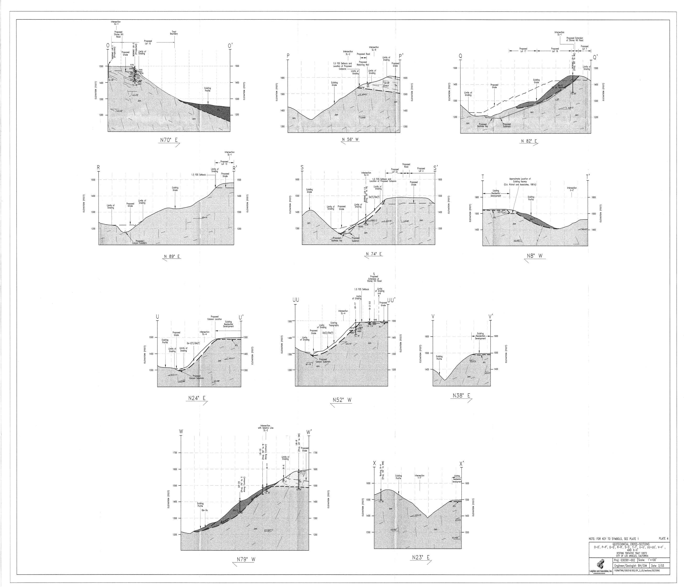
Geotechnical Cross Sections O-X 504kb
Appendix D Biota
1 Site Vicinity 120kb
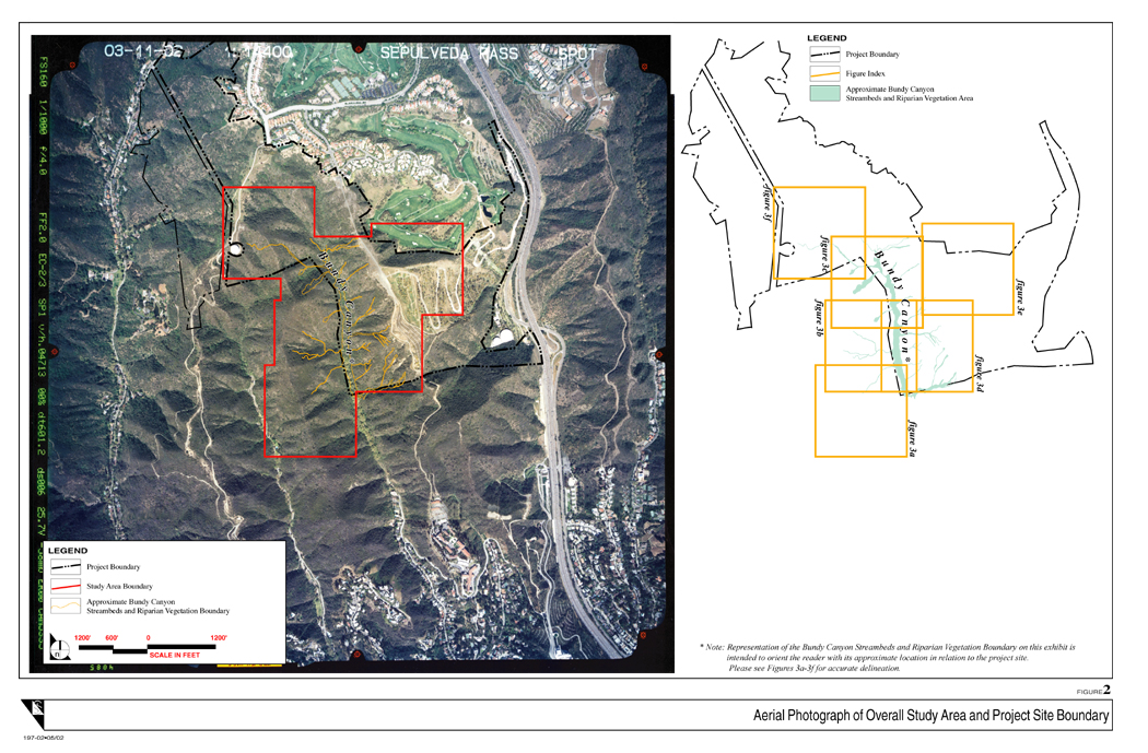
2 Aerial Photograph of Overall Study Area and Project Site Boundary 600kb
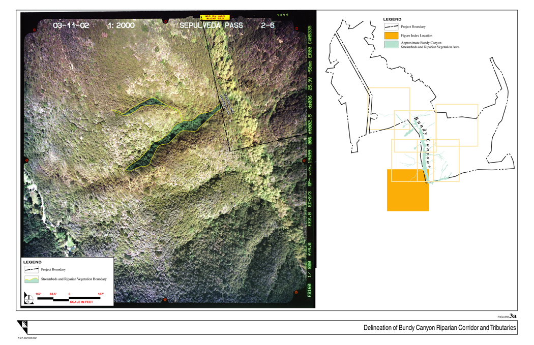
3a Delineation of Bundy Canyon Riparian Corridor and Tributaries 616kb
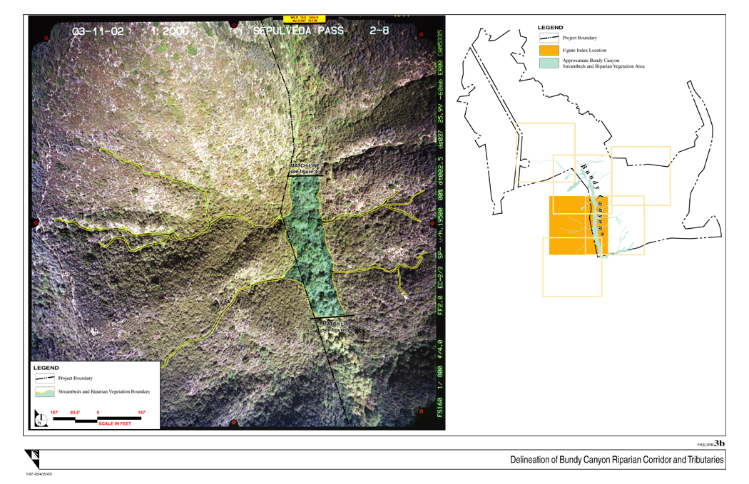
3b Delineation of Bundy Canyon Riparian Corridor and Tributaries 644kb
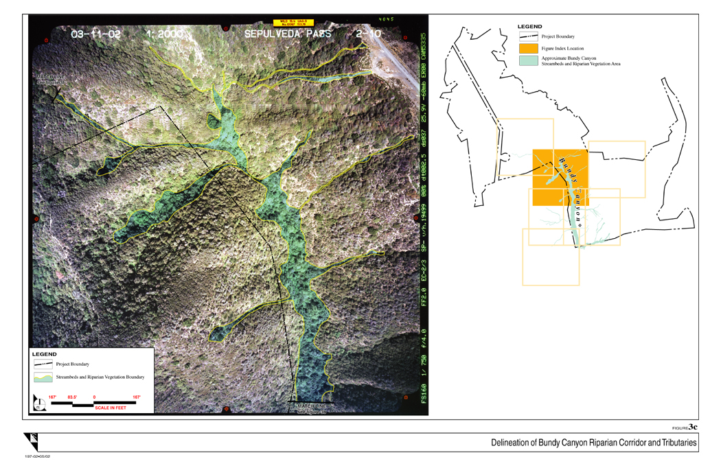
3c Delineation of Bundy Canyon Riparian Corridor and Tributaries 644kb
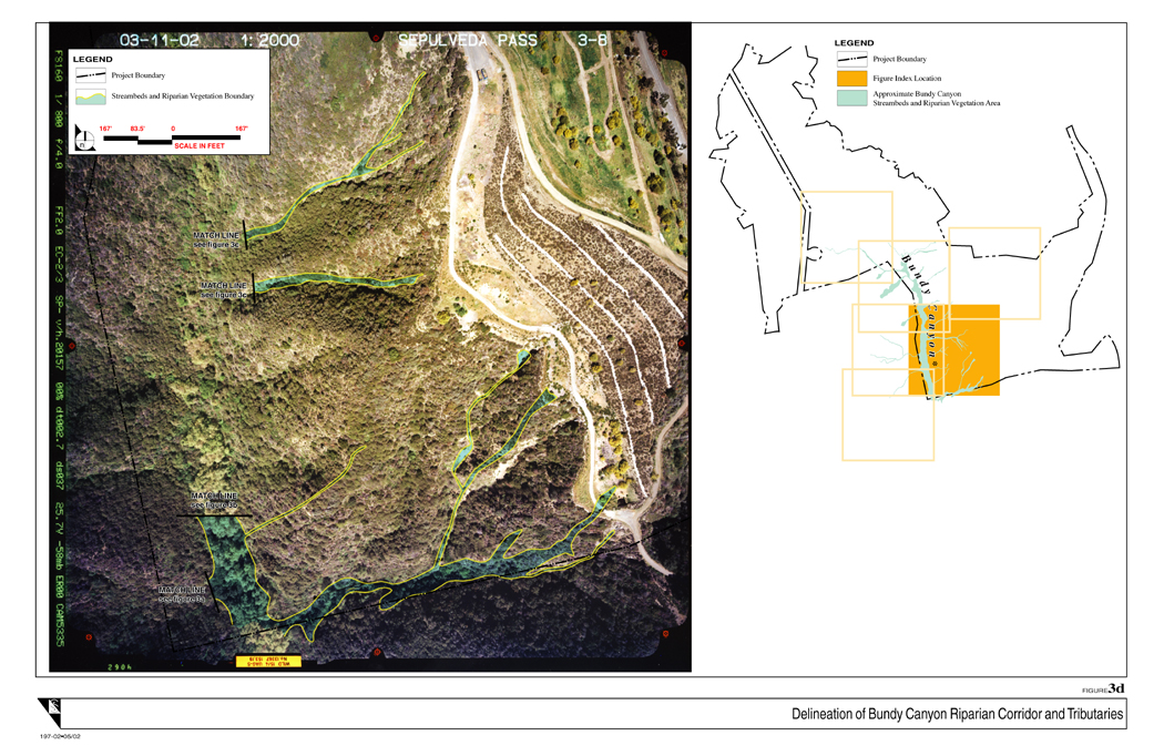
3d Delineation of Bundy Canyon Riparian Corridor and Tributaries 624kb
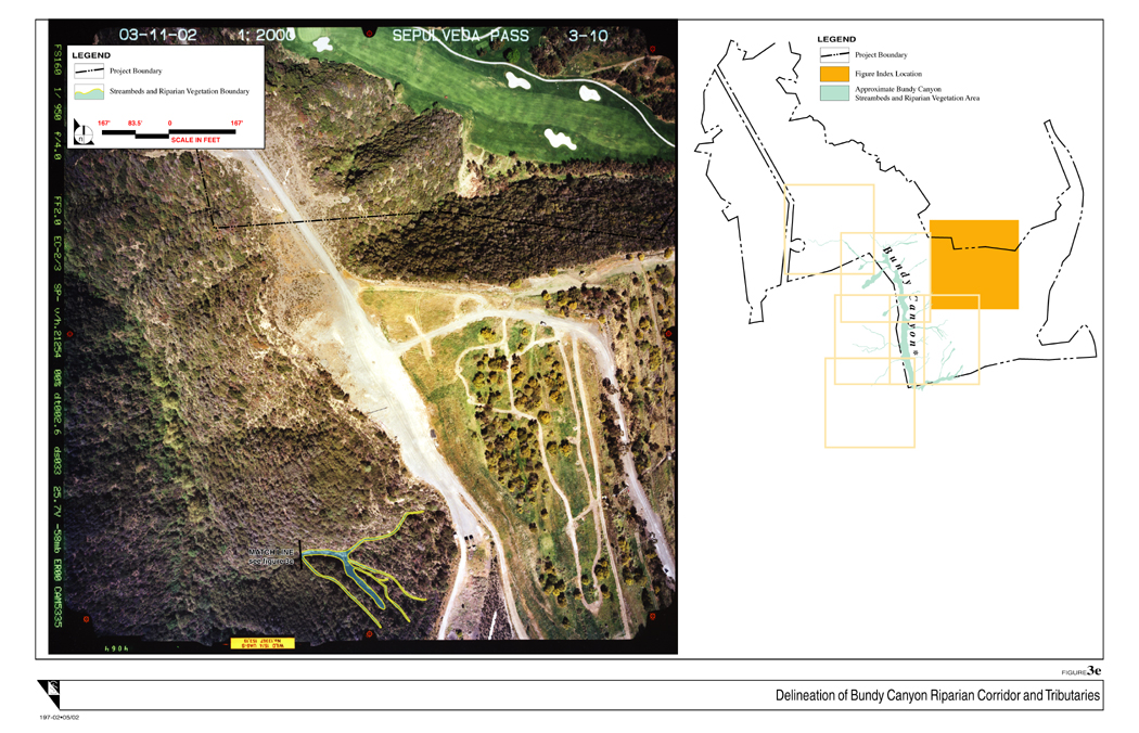
3e Delineation of Bundy Canyon Riparian Corridor and Tributaries 600kb
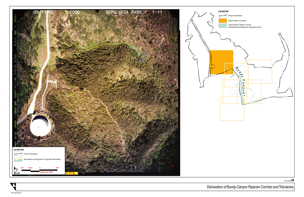
3f Delineation of Bundy Canyon Riparian Corridor and Tributaries 616kb
